Tuesday, June 7, 2016

June 3 to June 5

Pretty flower
Wichita Mountains Wildlife Nature Preserve
These next few days were quite uneventful.  On June 3, we continued our trip north from San Angelo, TX toward Oklahoma City.  We found a place in Meers, OK for dinner, and it supposedly had the best burger in Oklahoma.  Personally, I could make a better burger on my own grill, so the $15 was not worth the meal.  I suppose most of that price was paying for the atmosphere.  Anyway, we stopped a few times along the way to photograph wildlife.  I used my telephoto lens to take pictures of a bison in a meadow.  Some of the guests were brave enough to get within 20 feet of it, but I wanted to stay near the van in case it decided to charge.  As we continued, we came across another creature, but I was not sure what type it was.  Either way, it decided to lie down in the grass as we approached it, so we were able to take easy pictures.  When we arrived in Lawton, OK for the night, we checked into our hotel, and a few of us walked to the casino next door.  It was a fun time with great people!!  We drove 399 miles.
Bison

Twistex Memorial
On June 4, we drove the guests back to the base hotel in Oklahoma City.  Along the way, we drove through the path of the El Reno tornado that occurred on May 31, 2013.  At its peak, it was 2.7 miles wide and was packing winds of 295 mph, as measured by radar.  Seeing the damage from that storm was surreal, and we also passed by a house that looked "too new."  Looking at the storm's path, that house was directly in the middle of the damage path, so it was a safe assumption that the original house was obliterated.  Many trees were still damaged, and it was evident that there was no hope for them to grow back.  We also stopped at the Twistex Memorial.  This memorial honors the lives of Tim Samaras, Paul Samara, and Carl Young.  They were killed when the tornado suddenly changed its direction, picked up their cobalt, and threw it 100 yards with them inside.  These chasers were well-respected in the weather community, and they will be greatly missed.  However, their research has helped make tornado predictions better than before.  Between dropping off the guests at the hotel and beginning our drive to Denver for the next tour, I drove 445 miles and stayed in Ulysses, KS for the night.


Monday, June 6, 2016

June 2 Strengthening Ridge of Death

Small tarantula
Male peacock
Female peacock
Today was not looking too good for storm development.  A huge ridge was beginning to develop in the western part of the states, and this causes air to subside, or sink.  Storms need rising air to develop and strengthen, so this meant a ridge would effectively end our chase week early.  We left Del Rio, TX and began our journey north for Oklahoma City.  Our guests needed to be back by Saturday afternoon, and there was no sense in chasing in the southern tip of Texas.  Along the way, we stopped in Sonora, TX for lunch at a Mexican cafe.  The food was cheap and amazing!!  Bill decided to take the group to the Caverns of Sonora to kill some time.  We explored the underground caves and saw some neat wildlife.  Most of us were happy to emerge from the caves because the humidity was 98%.  There was a male and female peacock on the grounds, and one of the group members found a small tarantula under a rock.  Storms began developing when we were done with our cave tour, but they sputtered very quickly.  Bill was quite exhausted, so he found rooms for us in San Angelo, TX, and we had another very early night.  Our mileage for the day was 199 miles.
Caverns of Sonora


Caverns of Sonora

Sunday, June 5, 2016

June 1 Marathon, TX and Del Rio, TX supercells

Shear funnel
New wall cloud
Hail shaft
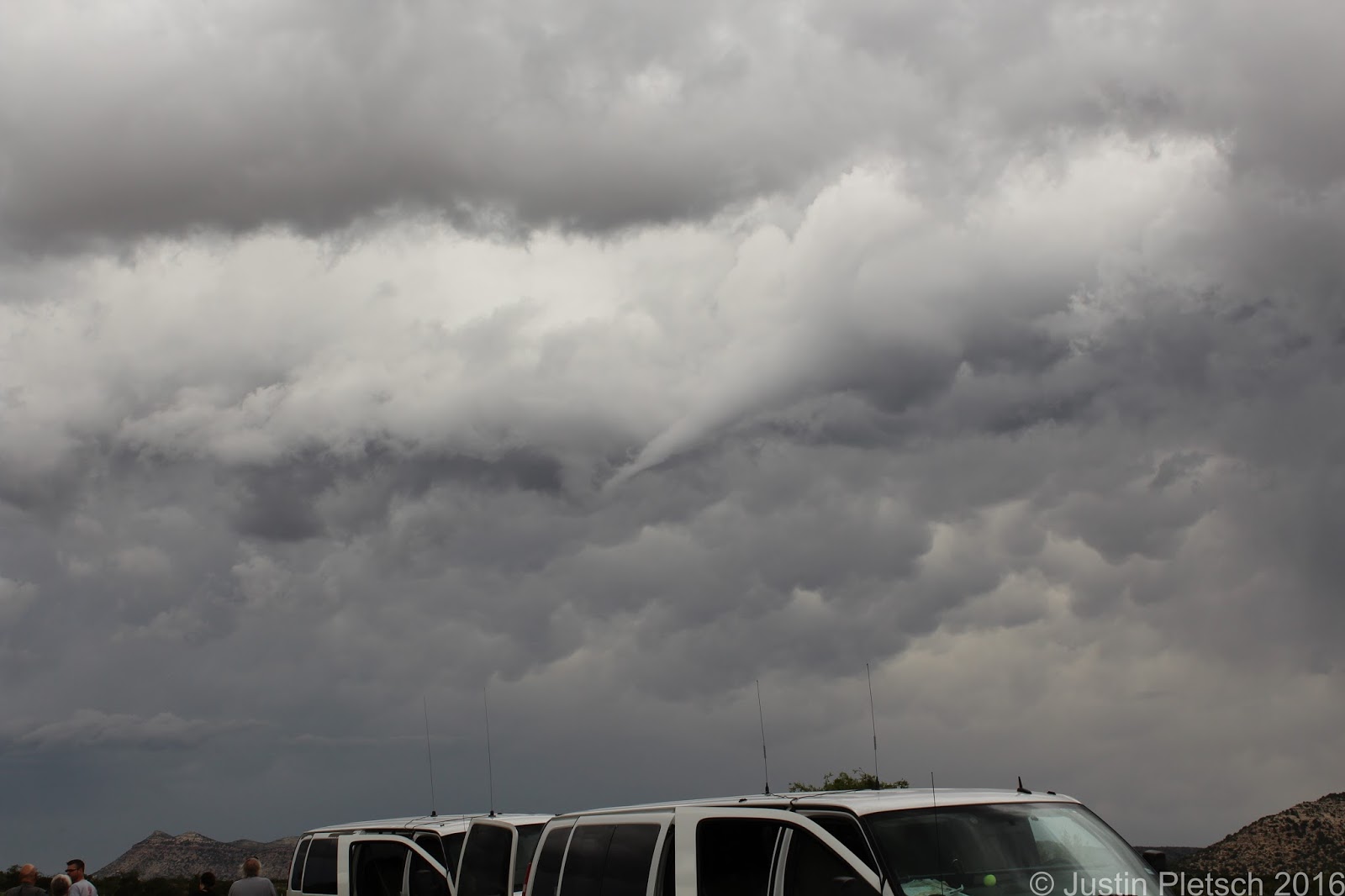
Today's plan was very straightforward.  We were already in great position in Alpine, TX, where we spent the previous night.  That being said, Bill decided to head 30 miles east where better moisture was present.  We stopped for lunch at the Oasis Cafe in Marathon, TX, and the poor waitress seemed to be overwhelmed by our presence.  I am pretty sure they are not used to getting 16 people at the same time, but she did a great job handling our appetites!  Anyway, we continued east out of Marathon after lunch and saw a few cells popping up.  There was a cell very close to our original starting point that was showing signs of dropping a tornado or two.  We turned around in Sanderson, TX after a pit stop and blasted back west to investigate this storm.  As we got closer, we could see a very nice base, and the storm was rotating.  We stopped alongside the road to watch it, and a very defined funnel began to form.  Seeing this, we felt this was a good omen for the day, because another funnel formed shortly after the initial one.  Sadly, the storm was having trouble getting its act together until a wall cloud began forming...directly over our heads!!!  This was very exciting, especially with the warm RFD winds coming from the storm.  We encountered atomized rain, which is just like going through a spot-free rinse in a car wash.  This is indicative that this storm is rotating hard, and this type of rain generally occurs when tornadogenesis is imminent.  Like before, the storm began sputtering.  RATS!!!  Fortunately, we were watching another cell about 60-70 miles to our east that was looking very healthy.  We decided to give the group one last pit stop before blasting east to investigate this other storm.  Along the way, we kept monitoring the storms behind us, and we stopped a few times when they were looking like possible tornado-producers.  Sanderson, TX was nailed with baseball-sized hail, according to a report on GRLevel.  We were happy to be out of that town!!!  We continued east and began getting closer to the storm near Del Rio, TX.  Bill Reid, our tour director, stated that "This storm has 'that look.'"  In other words, he was seeing that it could produce a tornado with all the signs it was exhibiting.  We saw a very nice funnel cloud coming from the base, but it did not drop down.  As we got closer, we could see 2 distinct lowerings from the base of the storm.  This storm was hanging onto an outflow boundary from a previous storm, and we knew that if it could hang onto it without the boundary surging southward, we would have a very good chance at seeing a tornado.  Unfortunately, the boundary surged southward, and this undercut the storm with cold air.  We stopped at the Amistad Reservoir to monitor the storm.  It looked like it would try to cycle up and give us a show, but outflow was the final product.  We were getting blasted by torrential rain, so we decided to call it a relatively early night and head to Del Rio, TX to our hotel.  We drove 322 miles today.
Storm trying to cycle up after getting hit with outflow


Thursday, June 2, 2016

5/31 Marfa, TX shelf cloud

Alpine, TX
Cactus
Marfa, TX
Near Alpine, TX
We began today in Alpine, TX, and we were in great position for the day's festivities.  Models showed storms developing to the west and moving east due to upper level winds.  Because of this, we decided to give the guests another grocery store run.  While they were shopping for more goodies, we took the vans to get vacuumed.  After we picked up the guests, we stopped at a local diner for lunch, which was called Reata's.  When lunch was over, we did a quick gas station stop to top off the vans and give the group an opportunity for a pit stop.  Storms are unpredictable, so pit stops might not happen once we get on a good storm.  We drove east out of town for 5 miles before finding a nice picnic area to wait for storm initiation.  There was a decent looking cell to our north that was trying to get its act together.  It's cloud tops kept increasing and decreasing, and it remained relatively stationary.  After lingering for a while, we decided to investigate this cell.  It gave us a decent wall cloud for a bit with a pronounced RFD cut.  For those of you who are not familiar with weather terminology, an RFD cut is a good sign that the storm is healthy and could possibly produce a tornado.  It occurs when rain-cooled air is pulled from the storm to the ground and helps initiate tornado development.  Unfortunately, this storm started producing outflow, which meant the storm was beginning to die.  We began working our way west towards Marfa, TX, because there was a storm in that vicinity that was showing promising signs.  Its base was pronounced and it was showing signs of rotation.  As we got closer, we were able to stop and watch it.  Like the previous cell, it started becoming outflowy and it gave us a photogenic shelf cloud.  We ended up in Alpine, TX for the night after driving 226 miles.
Marfa, TX


Wednesday, June 1, 2016

May 30 Big Bend storms

The Hudson Hornet in Marathon, TX
Neat truck
We began today in Lubbock, TX, and we were already in great position for the day's chase.  Our target area was 2-3 hours west, and storms were predicted to begin initiating early.  Along the way, we stopped in Seminole, TX for lunch at Dickey's BBQ.  The food was delicious, and I was able to get my BBQ fix in for the trip.  After lunch, we continued west and intercepted some storms near Ft. Stockton, TX.  As we continued to Marathon, TX, storms continued to fire, and we were trying to keep on the southern-most storm.  The goal of the day was to play the "tail-end charlie" to improve our chances of seeing a tornado.  Eventually, the storms became very messy and outflowish, so we settled on some lightning photography.  We drove south to Big Bend National Park to investigate some activity close to the border.  After driving within 13 miles of the Mexico along US 385, we headed back north to follow more storms.  As the evening wore on, 2 cells began to exhibit signs of rotation, but they were killed by outflow.  We spent the night in Alpine, TX after driving 466 miles.
Funnel east of Alpine, TX
Wall cloud south of Marathon, TX


Monday, May 30, 2016

New Mexico storms

Clovis, NM
Boise City, OK
We began the day in Lamar, CO, and we had two separate target areas to choose from.  Because one was in South Dakota and the other was in Texas, we would only be able to choose one.  During the weather briefing, we looked at models and forecasts.  Bill decided our best play would be in the Texas Panhandle, where our tornado chances seemed to be better.  In addition, the Panhandle play would put us in good position for the next day or two.  After leaving Lamar around 9 a.m., we had a pit stop in Springfield, CO and continued south to Boise City, OK.  We stopped at a small heritage museum for a bit while Bill looked at the data and decided what our next move would be.  There was a giant Tin Man and dinosaur to photograph, as well as a slice of a sequoia tree that was riddled with fire ants.  We continued south to Dalhart, TX, where we enjoyed a lovely lunch at Pizza Hut.  Shortly after lunch, storms were beginning to initiate much earlier than anticipated.  We blasted towards Channing, TX, where a storm was looking good.  As we got closer, the storm died, but more development was happening near Clovis, NM.  This cell was pretty much stationary, and we were able to get close to it with no issues.  However, we killed this one, too.  After abandoning this storm, we headed towards Dora, NM, where another good cell was happening.  Along the way, the Clovis cell became more organized, and we decided to head back to chase it.  We were treated to some good mid-level structure, and the storm was spinning hard before cold outflow from other storms undercut it.  At the end of the day, we were treated to a nice dust storm from the cold outflow, and the red dust provided good contrast to the pictures.  We drove 567 miles and stayed in Lubbock, TX for the night.
Milnsand, NM


Saturday, May 28, 2016

Boise City, OK storms

Today began my 16 day storm chasing vacation.  This will be another year driving for Tempest Tours, and Bill Reid is our fearless leader for this specific tour.  After the guests and staff went through introductions, Bill went through the safety orientation.  Once that was finished, we knew our plan for the day was simple.  We wanted to get in position for a potential chase day in South Dakota on Monday, so we began heading west and north.  There was an area near Abilene, TX that was highlighted in a severe risk area, but Bill knew it would be better for us to head closer southeast Colorado in the hopes of getting some storms.  Either way, we wound up getting closer to our target area of South Dakota.  We headed west on I-40 and jumped on U.S. 287 to Watonga, OK.  Once we arrived in Watonga, we continued west to Seiling, OK, where we had our first pit stop.  Lunch was in Woodward, OK, and we ate at a Braum's.  After lunch, we continued west to Boise City, OK, and we had another pit stop in Balko, OK.  The Cu field was looking better, which meant storms would soon go up.  A few showed up on radar near Boise City, but Bill was looking at southeast Colorado for better storms.  As we got closer to Boise City, we found an abandoned home to photograph with the storm in the background.  After spending 15 minutes with this picture stop, we fueled the vans in Boise City and headed north to Lamar, CO, where our rooms were booked for the night.  Along the way, storms near Pueblo, CO, were looking good, so we were hoping they could stay together.  We stopped a couple times to take pictures of vibrant rainbows, so we did not leave the day empty-handed.  Our total mileage for today was 427 miles.

*I will be adding pictures once I figure out how to use this new software!!*