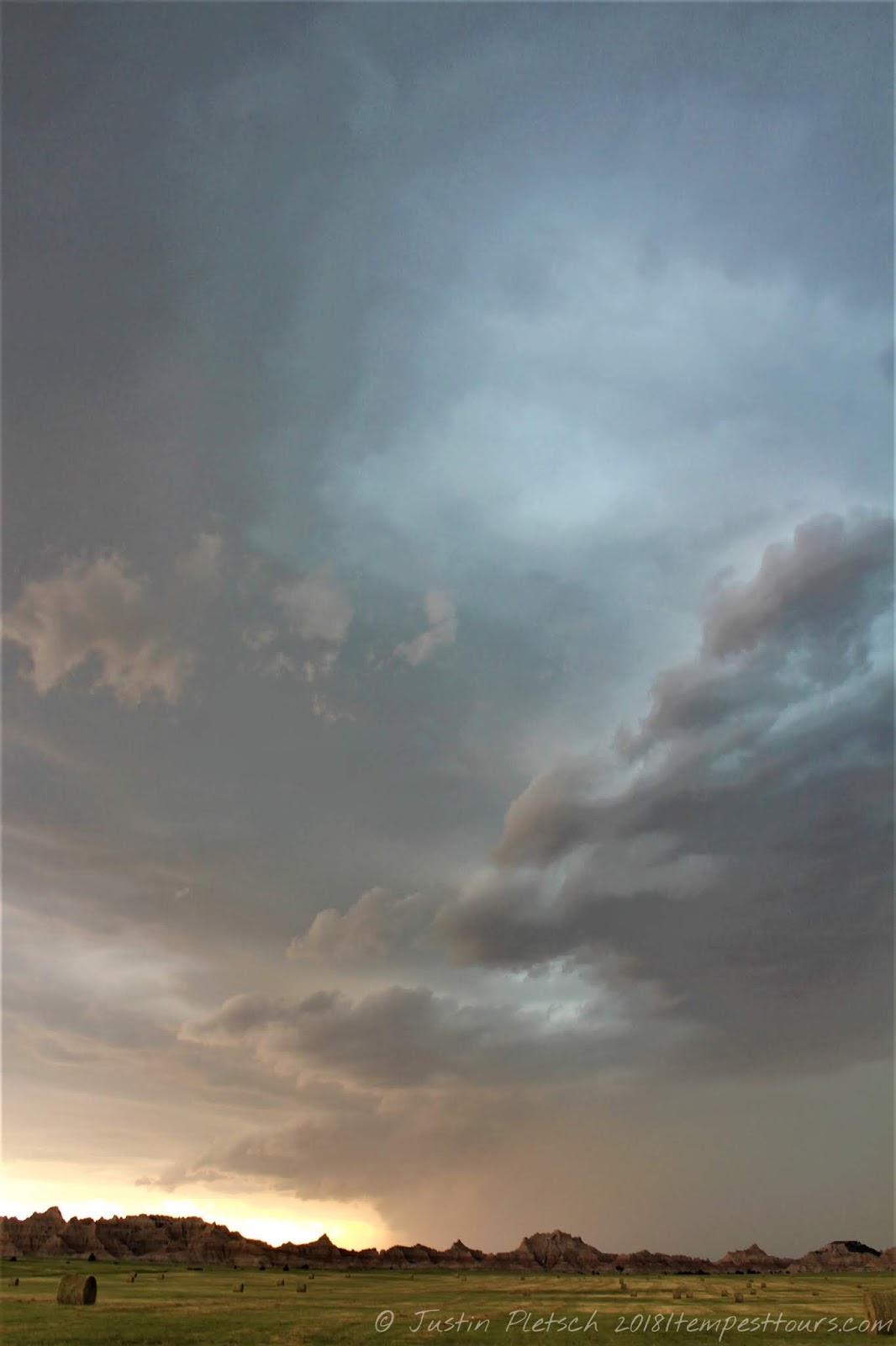
We began today in Gillette, WY, and there were a couple of options for us to choose from. Our first option was to make the play in eastern MT, and the other option was to blast north closer to the border of SK. Before we headed out, we found the Frontier Auto Museum and spent some time touring the facility. There were lots of classic cars on display, as well as vintage signs and gas station equipment. I spoke with one of the cashiers, and she said everything is part of her grandfather's collection. It was originally kept in a barn, but he was convinced to open up a museum to let the public enjoy everything. I am certainly glad he agreed to do this!! I will post pics of some of these treasures in a separate entry :)
After we were finished poking around, we headed north on WY 59, which turned into MT 59. We reached US 212, and we headed west into Broadus, MT, where we enjoyed lunch at the Powder River Stockman's Club. They were certainly not ready to accommodate our large group, but that is to be expected. We continued north out of Broadus on MT 59 into Miles City, MT. The chances of severe weather looked good near Miles City, and there was some convection from the morning moving into better air at this time. However, we did not want to get too wrapped up with this morning junk, so we opted to scoot west into Terry, MT, where we had a pit stop. The lady working the convenience store was not too happy to see us, and she made sure to let our group know about it. Perhaps she was having a bad day! After lingering in Terry for a while, we headed south on 10 Mile Road/Road 305 until we reached US 12. At the intersection, there was an old school house with a swing set that we investigated, and it made for some good photography opportunities. The mountainous terrain to our west provided a beautiful backdrop with a storm. Unfortunately, the storm was sputtering, and it looked like the atmospheric cap was going to win. However, there was nice tower going up to our south near Ekalaka, MT. This was in good air, and it looked promising. We blasted east on US 12 into Baker, MT, where we headed south on MT 7. We followed this road into Ekalaka, where we continued south and east on MT 323. This road allowed us to get east of the storm, which was nearly stationary, and we had an unfortunate encounter with a deer near Albion, MT as we were driving. Luckily, no one was hurt, but the same could not be said for the deer. The van was also heavily damaged but drivable. As we continued our drive, we found a place to stop to watch the storm and inspect the van. It was a neat experience standing in the open fields and watching this beast of a storm come right to us. We followed MT 323 into Alzada, MT, where the nice lady running the convenience store was kind enough to stay open for us. Our day ended in Belle Fourche yet again after driving 466 miles.
Sidenote: The impact with the deer was worse that we thought. It knocked out that van's AC for the remainder of the trip, which just happened to be warm and humid.
 |
| Intersection of US 12 and Road 305 |
 |
| East of Ekalaka, MT |
 |
| Getting closer... |


 NE 2 into Mullen, NE, where we had brunch at Red's Cafe. This was another example of a place that is clearly not equipped to deal with a large group, but I would certainly give it another chance if I found myself travelling through the town. We continued west into Alliance, NE, where we had a pit stop. During the pit stop, a handful of us took the van to a
  Napa store and found something to try and fix the AC. Sadly, the repair did not work, so we knew the AC was officially shot. After the pit stop, we continued on NE 2 into Hemingford, NE, where we found an old house to take our group picture. The models at this point were still wishy-washy with storm development, and the general trend was going down. Out of Hemingford, we took NE 71 west to Cut Across Road. This brought us to NE 29, where we headed north into Harrison, NE. From Harrison, we drove west on US 20 into Lusk, WY. After a pit stop, we drove south on US 85 to the town of Jay Em, WY. We poked around town for a while as we were waiting for something to
  happen with the weather. The atmospheric cap seemed to be getting stronger as the afternoon wore on, and our hopes for storms were dwindling. We continued south into Torrington, WY, where we had another pit stop. From Torrington, we continued south on US 85 until we reached WY 313. This
  road lead us into Chugwater, where we stopped for a final time. At this point, Bill unsheathed the big silver fork and called it a day. As he was calling around for rooms, some of us came across the Homesteaders Machinery Museum, which was free admission. There were lots of old pieces of
  machinery, and it was neat seeing these parts of history on display. He found rooms for us in Cheyenne, and we had our first real dinner of the trip. It was nice being able to eat with real plates and silverware! Our total mileage for the day was around 400 miles.
 NE 2 into Mullen, NE, where we had brunch at Red's Cafe. This was another example of a place that is clearly not equipped to deal with a large group, but I would certainly give it another chance if I found myself travelling through the town. We continued west into Alliance, NE, where we had a pit stop. During the pit stop, a handful of us took the van to a
  Napa store and found something to try and fix the AC. Sadly, the repair did not work, so we knew the AC was officially shot. After the pit stop, we continued on NE 2 into Hemingford, NE, where we found an old house to take our group picture. The models at this point were still wishy-washy with storm development, and the general trend was going down. Out of Hemingford, we took NE 71 west to Cut Across Road. This brought us to NE 29, where we headed north into Harrison, NE. From Harrison, we drove west on US 20 into Lusk, WY. After a pit stop, we drove south on US 85 to the town of Jay Em, WY. We poked around town for a while as we were waiting for something to
  happen with the weather. The atmospheric cap seemed to be getting stronger as the afternoon wore on, and our hopes for storms were dwindling. We continued south into Torrington, WY, where we had another pit stop. From Torrington, we continued south on US 85 until we reached WY 313. This
  road lead us into Chugwater, where we stopped for a final time. At this point, Bill unsheathed the big silver fork and called it a day. As he was calling around for rooms, some of us came across the Homesteaders Machinery Museum, which was free admission. There were lots of old pieces of
  machinery, and it was neat seeing these parts of history on display. He found rooms for us in Cheyenne, and we had our first real dinner of the trip. It was nice being able to eat with real plates and silverware! Our total mileage for the day was around 400 miles.
 June 10: After meeting in the lobby to get everyone rounded up, Bill treated everyone to a nice breakfast at The Egg & I. He felt bad that the van's AC was not working, and the breakfast was delicious. After breakfast, we drove south to our base hotel in Denver and dropped of the guests. It was bittersweet saying goodbye to them, because they were a fantastic group. We shared lots of laughs, storms, and bad jokes! Our mileage for today was 104 miles.