Wednesday, May 20, 2020

June 19, 2018 Prospect Valley, CO tornado

Hi everyone!  In case you can't tell, I am just a tad bit behind on my blog updates.  My goal is to get this updated before my storm chasing trip this summer. Yes, storm chasing is still going as planned, despite this pesky virus.  A lot has happened since the last time we met.  My wife and I bought a house last April, she gave birth to our second daughter July 2019, and I am in my final semester in my masters program.  I am scheduled to go chasing this year from July 5 - July 11, and I am looking forward to it!  Unfortunately, this virus has caused a lot of guests to be unable to chase this year, whether it is out of fear or because their respective countries have closed all travel.  Ok, enough of this rambling.  Let's get to the fun stuff!!

June 19, 2018

Let's do a very brief review up to this point. This was my second tour this summer, and this was a private tour led by Martin Lisius, President and CEO of Tempest Tours.  This tour had 2 Chinese pop stars and their entourage.  In all, we had 3 vans running with 5 staff and around 22 guests.  Talk about a logistical nightmare!  Thanks to the efforts of Kim George, HR director, the tour ran smoothly with very few hiccups.  I was given permission to use the write-up from Dr. Bob Conzemius.  He was acting as a driver/assistant tour director during this tour.

Longmont, CO; note the bowl-shaped lowering

Our last chase day of the tour proved to be the grand finale as Mother Nature really put on a show for us. We began at Fort Morgan, where the morning brought us a warm, humid airmass with that hazy look with meaty cumulus clouds that makes you feel it will be a good day of chasing.  Thinking storms would develop earlier today, we hurried south and got to Limon where we ate lunch at an assortment of fast food restaurants (mostly Taco Bell).

Once again, the first storms did not fire over the Palmer Divide, and when we finished lunch, we already had supercells from the Colorado/Wyoming border near Cheyenne, to Greeley, Longmont, and southwest of Denver.  The cell near Longmont looked the best.

We drove back to Byers then north on county roads to get a view of the bases of the Denver and Longmont storms. It was immediately clear that the northern storm had the most interesting base. The base was lowered, and it had a bowl-shaped look.  That appearance was occasionally altered by RFDs punching through it. Nevertheless, we debated which storm to chase until we heard Bill Reid on the radio stating that they were headed to the northern storm.  Our decision was made.

Prospect Valley, CO; fat stovepipe

We continued north and encountered some road construction that made us worry that we were going to get stuck.  Gladly, we did not, and we continued north as the storm produced another RFD surge, and soon Bill Reid came over the radio to report a tornado (the were a few miles closer than we were).  I looked ahead and could see what he was talking about. The tornado became more well defined as a narrow condensation funnel lowered to the visible horizon.  We found a place to pull over and view it.  We were behind a bit of a hill, so we could not see the dust swirling at the ground, but we still had a nice view.

Very photogenic

Once this tornado roped out, we observed the storm for a few more minutes but then noticed it was being cut off by new storms developing to our east.  At this point, it became clear that we needed to jump back on the southern cell we had been considering earlier.

Roping out

Soon, this second storm was tornado-warned.  We got back to Deer Trail and drove southeast for a bit on I-70 and then exited for about 20 minutes of good storm viewing.  The lighting on the wall cloud of the storm was fantastic, but our inflow was becoming a bit cooler. Temperature-dewpoint spreads in the air immediately to our south were also larger, and cloud bases were not as low as they had been with our first storm.

Structure with roping out

We made a couple more stops at I-70 exits to observe the storm.  Our inflow became cooler with time, and winds were more northeasterly rather than easterly like they had been at our first I-70 exit.  Soon, we were hit by a gust of some pretty cold air, and the outflow was definitely upon us. We made one more stand at Arriba then hopped back on I-70 and dropped south at Seibert.

Chinese crew admiring the storm; note the RFD cut

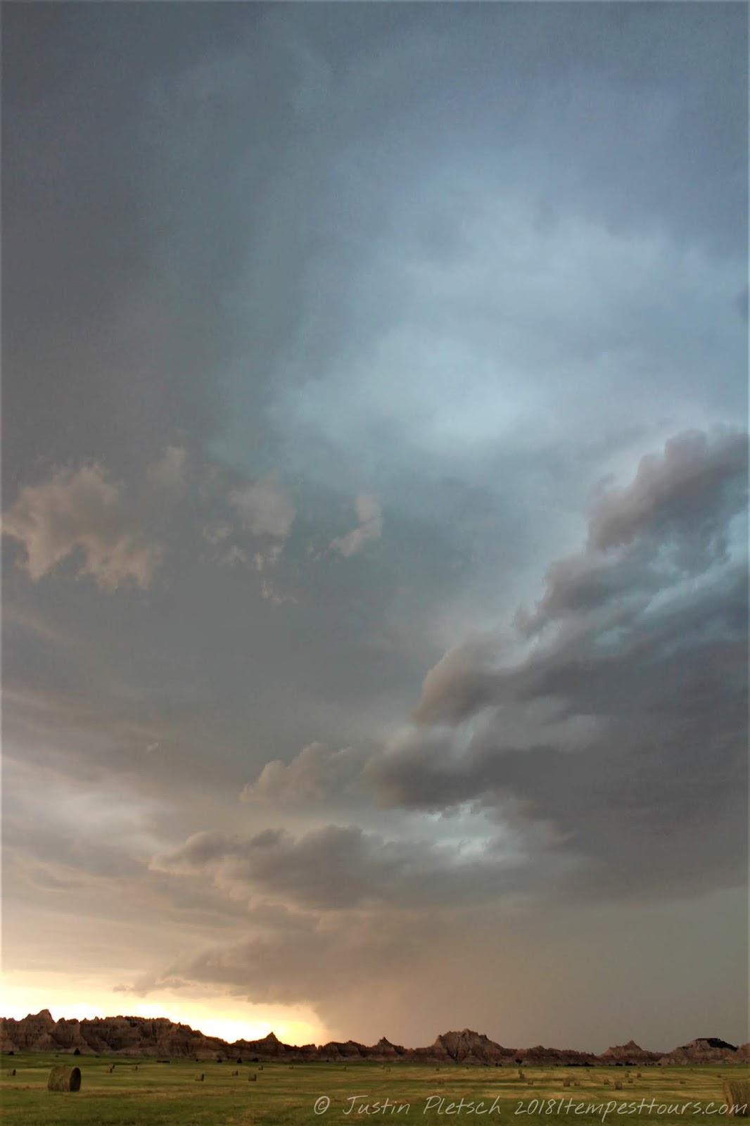
There were not a lot of road options, so had to go all the way to Kit Carson before coming back northwest toward our line of storms.  By then, all the trailing storms had become non-severe. We stopped on the way back to Limon and did some photography of the sun setting under thunderstorms.  We were also treated to a nice lightning show.

From there, we continued to Limon, where we ate a steak dinner at Oscar's Bar & Grille. Rooms were pretty booked in Limon, so we drove to Castle Rock to spend the night.

Deer Trail, CO
Our total mileage for this day, according to Dr. Bob's GPS, was 462 miles.  This was a fantastic way to end the tour and my two weeks of chasing in the Plains!!
Limon, CO

Thursday, September 20, 2018

June 18 Supercells near Denver


We began today in Ogallala, NE, and our plan was to head west towards Denver.  Models were hinting that storms would go up later in the day near the airport, so we wanted to get closer to that area.  After the morning briefing, we headed west on I-76 into Brush, where we had a fast food lunch.  Martin wanted to keep moving, because there was a small tornado chance today.  After lunch, we continued west in Wiggins, CO, where we had a pit/fuel stop.  We continued south on CO 52 until we reached Hoyt, CO, where 52 turned west.  We did some zig-zagging until we reached the town of Bennett, CO.  Once we were in Bennett, we found an open wheat field for the Chinese film crew to do some camera work.  Martin also used his drone to get more aerial shots of the pop stars.  We hung around the open wheat fields for a while, and this was a good time to look at data.  Nothing much was happening due to the cap, but models were still showing development in our general vicinity.  From Bennett, we headed east on I-70 to investigate an area of interest near Deer Trail, CO.  We found Jolly Road to set up shop, and we waited for something to happen.  After what seemed like an eternity, good cells began popping up north of the airport.  We needed to be on these cells ASAP!!  As we zig-zagged towards them, they looked good both visually and on radar.  We intercepted the better looking storm near Hudson, CO, and it had a nice wall cloud with it.  After following this storm into Fort Lupton, CO, we let the storm pass over us so we could get a better view of the wall cloud from behind.  As we followed this storm north on I-76, other storms in the area began to lose their discrete nature and become linear.  This was a good time to call it a chase and head into Fort Morgan, CO for the night.  We were treated to a nice sunset along the way, and we drove 362 miles.

Monday, September 10, 2018

June 17 SW NE/NE CO

We began today in Valentine, NE.  Our plan was to get further west near Ogallala, NE, as this was an anticipated hot spot for the day.  We drove south on US 83 into North Platte, where we had another fast food lunch.  After lunch, we needed to get further west where development was already occurring near Julesburg, CO.  We headed west on I-80, and as we got closer to Julesburg, the storm looked awesome on radar and it soon had a tornado warning.  We were able to see the area of rotation, and it was likely a tornado was on the ground at that time.  Unfortunately, trees and precipitation blocked our view.  We found an exit off of I-76 to stop for a bit and watch the storm. 
Julesburg, CO
Just north of Lake McConaughy
Elsie, NE
As the storm continued its march eastward, we followed suit and found ourselves watching the area of rotation occlude.  When we got to Ogallala, we drove north towards Lake McConaughy on NE 61 in the hopes that we would find some good roads to let us stay with that storm.  Sadly, this was not the case, but we were able to stop again and watch the storm some more.  There were some interesting lowerings, and an area of rotation quickly became apparent.  We dropped back to I-80 and headed towards North Platte, where we were finally able to get back in front of the storm.  Along the way, we saw some dusty spin-ups in the fields next to us.  At this point, other storms were beginning to form further to the east, which would prove to be fateful for the storm we were watching.

Despite the imminent death of our storm, there were new storms going up to our WSW, so we decided to target those.  These storms would have very little tornado potential, as they were along the cold front.  Still, it was worth investigating, and we drove south out of Ogallala on NE 61 to try and stay ahead of these new storms.  When we got into Grant, NE, we blasted east on NE 23.  We were getting hit hard by rain and wind, so we knew we had to get east fast.  Parts of the gust front had some areas of very tight/intense rotation.  As we approached Elsie, NE, we finally got out of the outflow, and we were able to stop and watch the approaching storm.  The NWS called Dr. Bob to ask about what was happening.  They were getting reports of tornadoes and wanted to verify the calls.  While there was a tight area of rotation, we were not able to confirm or deny any tornadoes.  We continued east into Wallace, NE, and a tornado warning was issued for the storm we were watching.  Radar indicated a tight circulation to our NW, but the rain wrapping around the area blocked our view.  A shelf cloud to our northeast also got wrapped into this area, and it was hard to determine whether or not a tornado was, indeed, in progress.  We stopped one last time between Wallace and Sutherland, NE on NE 25 to watch the storm.  Our rooms were at the Lonesome Dove Lodge in Ogallala.

June 16 storms near Hyannis, NE

Today was the start of my second tour of the season.  This was a private tour, and the guests were 2
Chinese pop stars with their entourage.  In all, there were 24 people on this tour, which is enough to make one's head spin.  I won't get into the dirty details about the logistics that were required to make this trip happen, but I will say that Kim George, Tempest's Guest Relations person, did a phenomenal job with booking rooms, keeping everyone happy, and figuring out how this was going to work!!  This tour was under the command of Martin Lisius, and his co-leader was Dr. Bob Conzemius.  We needed to pick up our guests in Boulder, CO, so we left our base hotel in Denver by 7:00 a.m.  After we arrived in Boulder, it took some time for everyone to get ready.  The plan was to head east into NE, where storms were expected to develop later.  A big factor in today's festivities was going to be how Hurricane Bud would affect storm chances.  Tropical systems that come from the Pacific tend to have lots of high cloudiness and decrease the atmospheric lapse rates (or how much the temperature decreases with height.)  If the tropical system comes from the Gulf of Mexico, it can ruin the amount of high quality moisture storms in the Plains have to play with.  *Please note that this information came from Dr. Bob's blog.  It can be found at http://tornadobob.com/)*

After everyone was ready to leave, we began our drive east from Boulder and took I-76 out of Denver into Sterling, CO.  From there, we headed north on US 138/CO 113.  When we crossed the CO/NE border, it turned into NE 19.  We continued north into Sidney, NE, where we had a quick fast food lunch.  After lunch, we headed north on US 385 into Alliance, NE.  Along the way, we stopped at Courthouse and Jail Rock for some photography opportunities.  Martin also launched his drone for some aerial shots of the pop stars and scenery.  We spent about 30 minutes at this site, and we were in pretty good position for later storm development.  When we arrived in Alliance, we had a pit stop, and this would be our last one for a while.  Storms were beginning to form east of Alliance closer to Hyannis.  Fortunately, NE 2 is a good east-west road, and the storms were moving from west-east.  We stopped about 7 miles west of Ellsworth, NE to watch a storm that seemed like it wanted to do something for us.  Sadly, it became outflow dominant, and it soon petered out.  However, there was more activity to our north and west, and this activity was moving in our direction.  After another pit stop in Hyannis, we headed north on NE 61 to investigate this new development.  There was very little traffic to deal with, and the Sand Hills offered some scenic views.  A decent supercell came rumbling through that had a nice roll cloud associated with it.  We eventually let the cell overtake us as we called the chase for the day.  We drove north into Merriman, NE, where we headed east on US 20 into Valentine, NE for the night after driving 492 miles.

June 9 and June 10 (cap bust and Denver drop-off)


NE 2
The Tempest group hanging out in Jay Em
June 9:  We began the day in Thedford, NE, and Bill did not seem too gung-ho about today's prospects.  That being said, we west on NE 2 into Mullen, NE, where we had brunch at Red's Cafe.  This was another example of a place that is clearly not equipped to deal with a large group, but I would certainly give it another chance if I found myself travelling through the town.  We continued west into Alliance, NE, where we had a pit stop.  During the pit stop, a handful of us took the van to a Napa store and found something to try and fix the AC.  Sadly, the repair did not work, so we knew the AC was officially shot.  After the pit stop, we continued on NE 2 into Hemingford, NE, where we found an old house to take our group picture.  The models at this point were still wishy-washy with storm development, and the general trend was going down.  Out of Hemingford, we took NE 71 west to Cut Across Road.  This brought us to NE 29, where we headed north into Harrison, NE.  From Harrison, we drove west on US 20 into Lusk, WY.  After a pit stop, we drove south on US 85 to the town of Jay Em, WY.  We poked around town for a while as we were waiting for something to happen with the weather.  The atmospheric cap seemed to be getting stronger as the afternoon wore on, and our hopes for storms were dwindling.  We continued south into Torrington, WY, where we had another pit stop.  From Torrington, we continued south on US 85 until we reached WY 313.  This road lead us into Chugwater, where we stopped for a final time.  At this point, Bill unsheathed the big silver fork and called it a day.  As he was calling around for rooms, some of us came across the Homesteaders Machinery Museum, which was free admission.  There were lots of old pieces of machinery, and it was neat seeing these parts of history on display.  He found rooms for us in Cheyenne, and we had our first real dinner of the trip.  It was nice being able to eat with real plates and silverware!  Our total mileage for the day was around 400 miles.

Blue sky bust
June 10:  After meeting in the lobby to get everyone rounded up, Bill treated everyone to a nice breakfast at The Egg & I.  He felt bad that the van's AC was not working, and the breakfast was delicious.  After breakfast, we drove south to our base hotel in Denver and dropped of the guests.  It was bittersweet saying goodbye to them, because they were a fantastic group.  We shared lots of laughs, storms, and bad jokes!  Our mileage for today was 104 miles.

June 8 Supercell near Wanblee and Norris, SD

We woke up this morning knowing that today was going to be our best chance to see a tornado.  The SPC had an enhanced risk not too far from where we were, and the conditions were going to be wonderful to see a tornado or two.  My night was very short as I had a bout of food poisoning from my "dinner" the night before.  Word to the wise:  Don't eat a chicken Caesar wrap at 11 p.m from a convenience store!!!  Anyway, we were on the road by 11:00 the next morning and headed south on US 85 into Rapid City, SD.  Along the way, we stopped in Sturgis to check out the town.  We had a quick fast food lunch in Rapid City and found a truck stop to make some


minor repairs to the damaged van.  At this time, a nice supercell was churning over the Black Hills near Sturgis, and chasers were quickly converging on the storm.  While it looked nice, Bill preferred to not chase in the hills, and I don't blame him.  We did not want to get caught in the chaser circus, and the area further to our southeast looked better.

After attempting to plug the leaks in the radiator with some fluid, we headed east on I-90 into Kadoka, SD, where the good parameters (and improving with each update) were for seeing supercells and tornadoes.  We dropped south on SD 73, and by the time we made it to our east option of SD 44, we were treated to a gorgeous supercell with a huge wall cloud to our west.  This was located east of Wanblee, SD, in case you are interested :)  We found a spot a couple miles to the west of SD 73 to watch the storm.  Outflow ruined our fun, for now, as the wall cloud dissipated while we were photographing the monster.  This was caused by the other cells in the area merging together, which resulted in a big HP beast of a storm.  Bill was not too hopeful of tornado prospects at the moment, even though the "super storm" was in very good air.  We decided to get a bit further east on SD 44 to stay ahead of the storm.  It is a good thing we did, because the storm began to reorganize, and there was some dust getting picked up under the base.  According to Bill's account, "This was looking a lot more like RFD wind, and perhaps a lurch towards tornado development, rather than cool outflow and undercutting."  We got about halfway between SD 73 and SD 63, where we found a spot to pull over and watch this storm.  By now, the storm had a rapidly spinning wall cloud underneath it, and it looked like the whole storm was rotating very hard!!!.  Tornado development seemed imminent, and it was very similar to how the El Reno tornado developed in May 2013.  We were very excited for what *could* happen, especially with how high the shear values were in the storm (148 knots.)  Values this high usually result in tornadoes, and Bill felt that it would have dropped a very large and violent tornado if this all transpired.  We began to feel cool air coming from the direction of the storm.  This is a chaser's worst nightmare when it comes to a potentially tornadic storm, because cool air means instant storm death.

The storm began to make a turn to the southeast, and we took our south option on SD 63.  By this time, the storm was pouring rain and throwing lightning bolts left and right.  Because of the high amount of precipitation, we could not make out anything in the RFD notch.  Bill believes something was in there, but it was too hard to tell due to the torrential rain.  We stopped about halfway to Norris, SD and stared at the storm.  There was something "interesting" happening a few miles to our west, and there was a tight couplet on the Rapid City radar.  Was there a significant tornado in that mess?  We will probably never be certain, but odds are, there was.  After a few minutes of watching, we noticed rain curtains beginning to rapidly rotate around the storm.  We needed to get out of there now!!!!  We were in the "bear's cage" which is where tornadoes love to develop.  In this case, it would have developed right on top of us if we didn't get ourselves out of harm's way.  It was a fun experience to drive the van while getting pounded with the wet RFD.  We managed to escape without any harm, and we also got to experience atomized rain.  This type of rain is generally seen in tornadic storms, so it was a welcome sign.  We made it to Norris and headed a couple miles east to watch our storm.  It looked a bit more unorganized, but it sure gave us a good run!


From Norris, it grew weaker and more outflowish, and it chased us into Parmelee, SD.  We headed east out of Parmelee on US 18 and headed into Mission, SD for a brief pit stop.  The locals were all amazed by the impending storm, but I think they were also a bit scared to see a group of storm chasers pulling in.  At this point, the storm was all outflow, and we needed to blast south on US 83 to stay out of the rain.  Along the way, we made a couple of stops to watch the storm, and we drove into Valentine, NE for dinner.  Our dinner was cut short because the storm was moving faster than we anticipated, so many of us did not get anything.  Such is the life of a chaser!  We found ourselves in Thedford, NE for the night after driving 372 miles.

June 7 Ekalaka, MT supercell

We began today in Gillette, WY, and there were a couple of options for us to choose from.  Our first option was to make the play in eastern MT, and the other option was to blast north closer to the border of SK.  Before we headed out, we found the Frontier Auto Museum and spent some time touring the facility.  There were lots of classic cars on display, as well as vintage signs and gas station equipment.  I spoke with one of the cashiers, and she said everything is part of her grandfather's collection.  It was originally kept in a barn, but he was convinced to open up a museum to let the public enjoy everything.  I am certainly glad he agreed to do this!!  I will post pics of some of these treasures in a separate entry :)

After we were finished poking around, we headed north on WY 59, which turned into MT 59.  We reached US 212, and we headed west into Broadus, MT, where we enjoyed lunch at the Powder River Stockman's Club.  They were certainly not ready to accommodate our large group, but that is to be expected.  We continued north out of Broadus on MT 59 into Miles City, MT.  The chances of severe weather looked good near Miles City, and there was some convection from the morning moving into better air at this time.  However, we did not want to get too wrapped up with this morning junk, so we opted to scoot west into Terry, MT, where we had a pit stop.  The lady working the convenience store was not too happy to see us, and she made sure to let our group know about it.  Perhaps she was having a bad day!  After lingering in Terry for a while, we headed south on 10 Mile Road/Road 305 until we reached US 12.  At the intersection, there was an old school house with a swing set that we investigated, and it made for some good photography opportunities.  The mountainous terrain to our west provided a beautiful backdrop with a storm.  Unfortunately, the storm was sputtering, and it looked like the atmospheric cap was going to win.  However, there was nice tower going up to our south near Ekalaka, MT.  This was in good air, and it looked promising.  We blasted east on US 12 into Baker, MT, where we headed south on MT 7.  We followed this road into Ekalaka, where we continued south and east on MT 323.  This road allowed us to get east of the storm, which was nearly stationary, and we had an unfortunate encounter with a deer near Albion, MT as we were driving.  Luckily, no one was hurt, but the same could not be said for the deer.  The van was also heavily damaged but drivable.  As we continued our drive, we found a place to stop to watch the storm and inspect the van.  It was a neat experience standing in the open fields and watching this beast of a storm come right to us.  We followed MT 323 into Alzada, MT, where the nice lady running the convenience store was kind enough to stay open for us.  Our day ended in Belle Fourche yet again after driving 466 miles.

Sidenote:  The impact with the deer was worse that we thought.  It knocked out that van's AC for the remainder of the trip, which just happened to be warm and humid.

Intersection of US 12 and Road 305

East of Ekalaka, MT


Getting closer...