We woke up this morning knowing that today was going to be our best chance to see a tornado. The SPC had an enhanced risk not too far from where we were, and the conditions were going to be wonderful to see a tornado or two. My night was very short as I had a bout of food poisoning from my "dinner" the night before. Word to the wise: Don't eat a chicken Caesar wrap at 11 p.m from a convenience store!!! Anyway, we were on the road by 11:00 the next morning and headed south on US 85 into Rapid City, SD. Along the way, we stopped in Sturgis to check out the town. We had a quick fast food lunch in Rapid City and found a truck stop to make some

minor repairs to the damaged van. At this time, a nice supercell was churning over the Black Hills near Sturgis, and chasers were quickly converging on the storm. While it looked nice, Bill preferred to not chase in the hills, and I don't blame him. We did not want to get caught in the chaser circus, and the area further to our southeast looked better.
After attempting to plug the leaks in the radiator with some fluid, we headed east on I-90 into Kadoka, SD, where the good parameters (and improving with each update) were for seeing supercells and tornadoes. We dropped south on SD 73, and by the time we made it to our east option of SD 44, we were treated to a gorgeous supercell with a huge wall cloud to our west. This was located east of Wanblee, SD, in case you are interested :) We found a spot a couple miles to the west of SD 73 to watch the storm. Outflow ruined our fun, for now, as the wall cloud dissipated while we were photographing the monster. This was caused by the other cells in the area merging together, which resulted in a big HP beast of a storm. Bill was not too hopeful of tornado prospects at the moment, even though the "super storm" was in very good air. We decided to get a bit further east on SD 44 to st
 ay ahead of the storm. It is a good thing we did, because the storm began to reorganize, and there was some dust getting picked up under the base. According to Bill's account, "This was looking a lot more like RFD wind, and perhaps a lurch towards tornado development, rather than cool outflow and undercutting." We got about halfway between SD 73 and SD 63, where we found a spot to pull over and watch this storm. By now, the storm had a rapidly spinning wall cloud underneath it, and it
  looked like the whole storm was rotating very hard!!!. Tornado development seemed imminent, and it was very similar to how the El Reno tornado developed in May 2013. We were very excited for what *could* happen, especially with how high the shear values were in the storm (148 knots.) Values this high usually result in tornadoes, and Bill felt that it would have dropped a very large and violent tornado if this all transpired. We began to feel cool air coming from the direction of the storm. This is a chaser's worst nightmare when it comes to a potentially tornadic storm, because cool ai
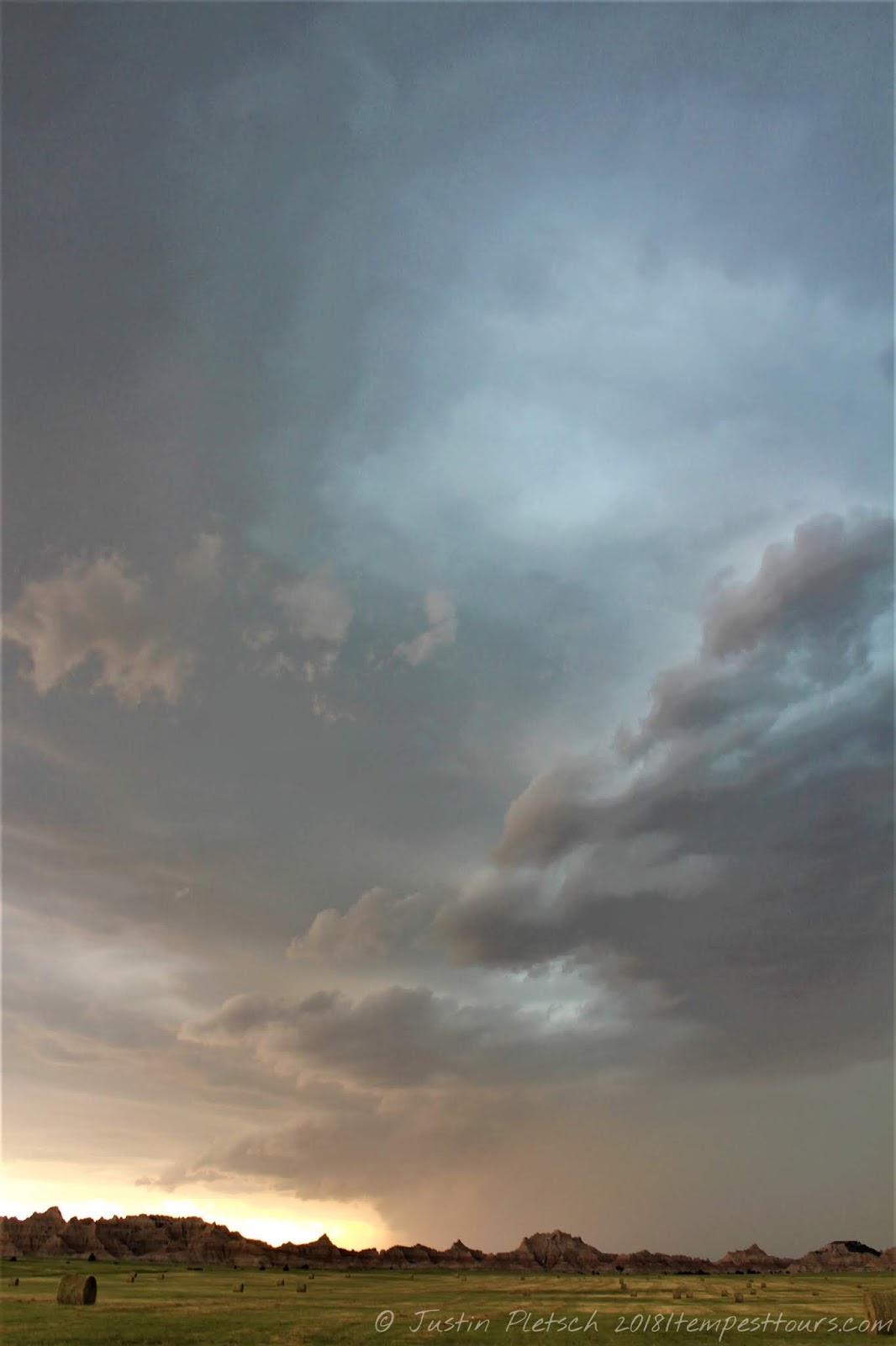 r means instant storm death.
The storm began to make a turn to the southeast, and we took our south option on SD 63. By this time, the storm was pouring rain and throwing lightning bolts left and right. Because of the high amount of precipitation, we could not make out anything in the RFD notch. Bill believes something was in there, but it was too hard to tell due to the torrential rain. We stopped about halfway to Norris, SD and stared at the storm. There was something "interesting" happening a few miles to our west, a
 nd there was a tight couplet on the Rapid City radar. Was there a significant tornado in that mess? We will probably never be certain, but odds are, there was. After a few minutes of watching, we noticed rain curtains beginning to rapidly rotate around the storm. We needed to get out of there now!!!! We were in the "bear's cage" which is where tornadoes love to develop. In this case, it
  would have developed right on top of us if we didn't get ourselves out of harm's way. It was a fun experience to drive the van while getting pounded with the wet RFD. We managed to escape without any harm, and we also got to experience atomized rain. This type of rain is generally seen in tornadic storms, so it was a welcome sign. We made it to Norris and headed a couple miles east to watch our storm. It looked a bit more unorganized, but it sure gave us a good run!
 From Norris, it grew weaker and more outflowish, and it chased us into Parmelee, SD. We headed east out of Parmelee on US 18 and headed into Mission, SD for a brief pit stop. The locals were all amazed by the impending storm, but I think they were also a bit scared to see a group of storm chasers pulling in. At this point, the storm was all outflow, and we needed to blast south on US 83 to stay out of the rain. Along the way, we made a couple of stops
  to watch the storm, and we drove into Valentine, NE for dinner. Our dinner was cut short because the storm was moving faster than we anticipated, so many of us did not get anything. Such is the life of a chaser! We found ourselves in Thedford, NE for the night after driving 372 miles.
No comments:
Post a Comment