 |
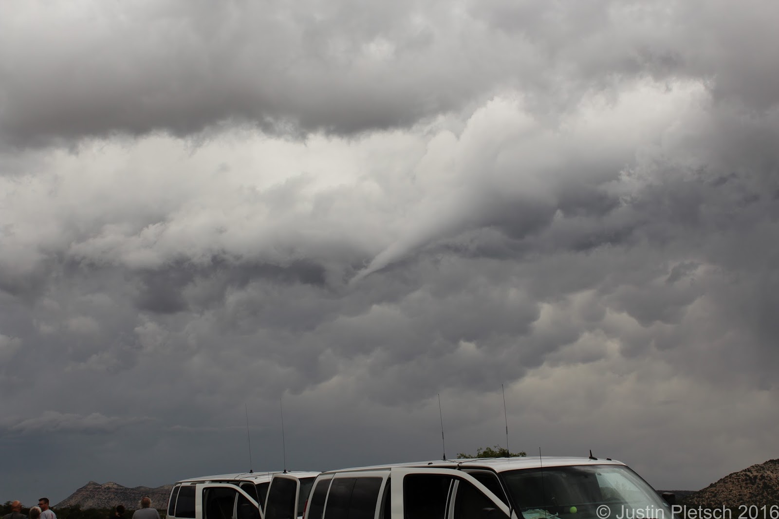
| Shear funnel |
 |
| New wall cloud |
 |
| Hail shaft |
Today's plan was very straightforward. We were already in great position in Alpine, TX, where we spent the previous night. That being said, Bill decided to head 30 miles east where better moisture was present. We stopped for lunch at the Oasis Cafe in Marathon, TX, and the poor waitress seemed to be overwhelmed by our presence. I am pretty sure they are not used to getting 16 people at the same time, but she did a great job handling our appetites! Anyway, we continued east out of Marathon after lunch and saw a few cells popping up. There was a cell very close to our original starting point that was showing signs of dropping a tornado or two. We turned around in Sanderson, TX after a pit stop and blasted back west to investigate this storm. As we got closer, we could see a very nice base, and the storm was rotating. We stopped alongside the road to watch it, and a very defined funnel began to form. Seeing this, we felt this was a good omen for the day, because another funnel formed shortly after the initial one. Sadly, the storm was having trouble getting its act together until a wall cloud began forming...directly over our heads!!! This was very exciting, especially with the warm RFD winds coming from the storm. We encountered atomized rain, which is just like going through a spot-free rinse in a car wash. This is indicative that this storm is rotating hard, and this type of rain generally occurs when tornadogenesis is imminent. Like before, the storm began sputtering. RATS!!! Fortunately, we were watching another cell about 60-70 miles to our east that was looking very healthy. We decided to give the group one last pit stop before blasting east to investigate this other storm. Along the way, we kept monitoring the storms behind us, and we stopped a few times when they were looking like possible tornado-producers. Sanderson, TX was nailed with baseball-sized hail, according to a report on GRLevel. We were happy to be out of that town!!! We continued east and began getting closer to the storm near Del Rio, TX. Bill Reid, our tour director, stated that "This storm has 'that look.'" In other words, he was seeing that it could produce a tornado with all the signs it was exhibiting. We saw a very nice funnel cloud coming from the base, but it did not drop down. As we got closer, we could see 2 distinct lowerings from the base of the storm. This storm was hanging onto an outflow boundary from a previous storm, and we knew that if it could hang onto it without the boundary surging southward, we would have a very good chance at seeing a tornado. Unfortunately, the boundary surged southward, and this undercut the storm with cold air. We stopped at the Amistad Reservoir to monitor the storm. It looked like it would try to cycle up and give us a show, but outflow was the final product. We were getting blasted by torrential rain, so we decided to call it a relatively early night and head to Del Rio, TX to our hotel. We drove 322 miles today.
 |
| Storm trying to cycle up after getting hit with outflow |


Okay, now it's getting exciting!
ReplyDeleteUnfortunately, this was the most exciting day of the week. The weather pattern gets much worse from here :(
ReplyDelete